BG-Map
Powerful and Easy to Use Collections Mapping for Botanical Gardens and Arboreta
|
What is BG-Map?
With BG-Map You Can:
● Map Your Plant Collection
● Seamlessly Link Your Map to BG-BASE™
● Share Your Map and Data Over the Web
● Use Web and Mobile Technologies to
Manage Your Plant Collection
BG-Map is the most widely used mapping software specifically designed for botanical gardens and similar
institutions.
If you work at a botanical garden, arboretum, college campus, private estate, cemetery, zoo, municipality or other facility where
detailed records and mapping of trees, plants and infrastructure are critical, then BG-Map is the right
solution for you.
How Does BG-Map Differ From BG-BASE?
BG-BASE™ is collections management database software developed and supported by BG-BASE, Inc. and BG-BASE UK Ltd. BG-Map is mapping software that links to the plant records stored in BG-BASE, creating a powerful Geographic Information System (GIS).
|
|
Why BG-Map?
It's Easy and Powerful
It's Easy to Use
Other mapping systems may burden you with lots of technical jargon and complex procedures for producing
even the simplest maps.
Others may provide simplicity by using a "Cookie Cutter Approach", treating each installation more or less the same way.
In contrast, BG-Map is packed with easy to use features designed for non-technical garden staff.
And, BG-Map provides a highly customizable interface that can be tailored to each user.
"You Don't Need to be a
GIS Expert to Use BG-Map..."
And It's Powerful
BG-Map is the only available mapping software that links directly to BG-BASE™ without the need for
exporting or importing.
And, with the optional Web Interface, you and your visitors can access a wealth of information about your garden and collections, including maps and images.
"The implementation of the software (BG-Map) went very well for us.
We were complete by the end of August, and C. has been mapping all of our new garden renovations this year.
It's almost intimidating how much the software can do."
Peter Couchman, Executive Director, High Glen Estate
|
What About Low Cost or "Free" Mapping Software?
Staff time is valuable. Unlike some low cost or "free" software, BG-Map is not a toolkit that comes
with a long learning curve. It's complete and ready to go right away.
And, BG-Map is designed to do exactly what you need to do quickly and with a minimum of fuss.
You don't need to learn about database structures, topology, rules, schema, classes, exporting or formatting.
You have better things
to do with your time!
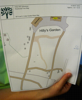
With just a few clicks, you can find a plant, print a customized map or create a report.
|
BG-Map Support
The Software Maintenance Program provides technical support and software updates for a
single annual fee, assuring that your software is always current.
The Users Support Website offers TechNotes, surveying tips, downloads and a searchable online forum where you can post questions and look up information.
|
"I have worked with BG-Map for six years now, and I still don't know where
I would be without you and your fabulous technical support. From the silly questions to the really tough problems
I come up with, you are always willing to talk me through it or get back to me quickly. You never shrink form
creating new solutions for the special needs of Mt. Cuba Center. We have a much stronger plant records department
as a result."
Amy Highland, Mount Cuba Center
|
|
|
|
How to Purchase and Install BG-Map
Check out the BG-Map Price List or Contact BG-Map to receive a detailed proposal specific to your installation requirements.
To create a BG-Map installation,
a basemap of your garden will be required. Each BG-Map purchase
includes on-site installation and training of your staff.
|
|
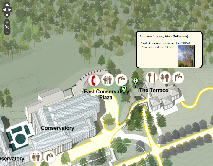
Power Your Website with BG-Map |
Power Your Website with

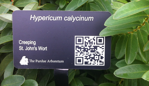
Add the power and capabilities of BG-Map to your website with Web-VQF. Visitors will learn about your garden and create their own maps with ease from home or on-site. And, your staff will gain unprecedented access to plant records and location maps.
|
Mobile Solutions
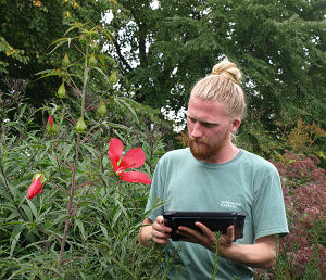
Use software from BG-Map with your Mobile device to view and update your plant records, map plant locations, and more.
|
|
GPS and Surveying
BG-Map is adaptable to various techniques for surveying plant locations.
From manual tape measurements to GPS, BG-Map can provide a surveying solution for you.
Choose the Total Station Interface for fast and highly accurate
surveying using electronic total station laser measuring instruments.
Or, choose the GPS Interface to use the latest in satellite global
positioning technology to speed the process of mapping your plant collections.
|
|

|
BG-Map Users
BG-Map has beeen installed in public and private gardens throughout the U.S. and beyond. Find out more about these users here:
|


© 2025 Glicksman Associates, Inc. All rights reserved
|


